Location
Surrey, British Columbia
Expertise
Transportation
Highways
Structures
Share
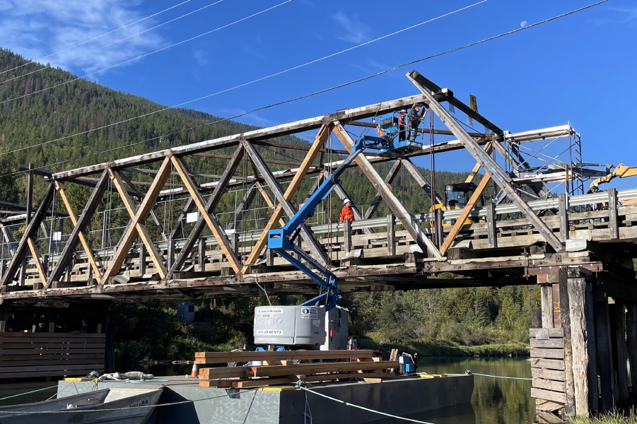
The Port Mann Highway 1 (PMH1) corridor is the most significant commuter and goods movement route in the Lower Mainland of British Columbia, linking the region to the rest of the province and country.
Congestion on the corridor has reached a critical level, compromising mobility and reliability of this major artery.
The PMH1 Project includes widening the highway, constructing a new Port Mann Bridge and upgrading interchanges to improve access and safety on Highway 1 from the McGill Interchange in Vancouver to 204 Street in Langley.


Project Highlights
11 km
Highway


The Project is being delivered by the newly established Transportation Investment Corporation (TICorp), using a Design-Build delivery model. Kiewit-Flatiron General Partnership is the design-build contractor. Associated Engineering’s subsidiary company, Brybil Projects, undertook the detailed design of the following as a subconsultant to Kiewit-Flatiron’s lead designers:
- Upgrading 11 km of Highway 1 to four lanes in each direction from 168 Street to 200 Street, reconstructing the interchange at 176 Street, and maintaining connections to the existing interchanges at 192 and 200 Streets.
- Designing the Fraser Heights Connector, which includes upgrading 176 Street from the interchange northward to a new intersection with 104 Avenue, approximately 2.5 km of the South Fraser Perimeter Road including a 450 m long viaduct across a wetland, and the new 2 km Golden Ears Connector east from the 104 Avenue/176 Street intersection to the new Golden Ears Way.
Brybil Projects’ scope of services included preparing the design concept and detailed design of all roadways, structures, interchanges, and drainage for the project segments described above to enable Kiewit-Flatiron to perform the construction work, and included support to Kiewit-Flatiron for meetings with the TICorp, government agencies, utility agencies and other parties to obtain the necessary permits and approvals.
People on this project

More Transportation Projects
See all projects


Transportation
7 Avenue S. Bike Boulevard


Streetscaping
Nigel Valley Public Spaces

Transportation
Still Creek Pedestrian Bridge Replacement

Transportation
Fourth Street Pedestrian Overpass

Streetscaping
Vanalman Avenue Upgrades

Airports
Calgary Airport Glycol Treatment Facility

Transportation
Agassiz-Rosedale Bridge – Renewal Options Analysis and Preliminary Rehabilitation Design

Transportation
Kitsault Mine Access Road and Bridge Assessments

Transportation
Granville Bridge Seismic Retrofit and Renewal

Transportation
Pedestrian Bridge 151 Rehabilitation

Infrastructure
Chippewas of Nawash First Nation – Roads and Culvert Flood Damage Repair

Infrastructure
Churchill Airport Runway Upgrades

Transportation
Highway 17 at County Road 508 Interchange

Land Development
Royal Bay Subdivision

Transportation
Bermuda Runway Rehabilitation
LEADERSHIP INSIGHTS
See all insights