Location
Oakville, Ontario
Expertise
Infrastructure
Containment Systems
Environmental Engineering
Pump Stations
Share
For over 20 years ending in 1982, the Oakville Fourth Line Landfill in the Regional Municipality of Halton received the town’s waste.
Subsequently, the Region constructed a new toe drain and leachate pump station to more effectively manage the accumulating leachate and protect the surrounding environment. The management strategy for handling the leachate included recirculating it at the landfill and hauling the leachate off-site by tanker truck for treatment.
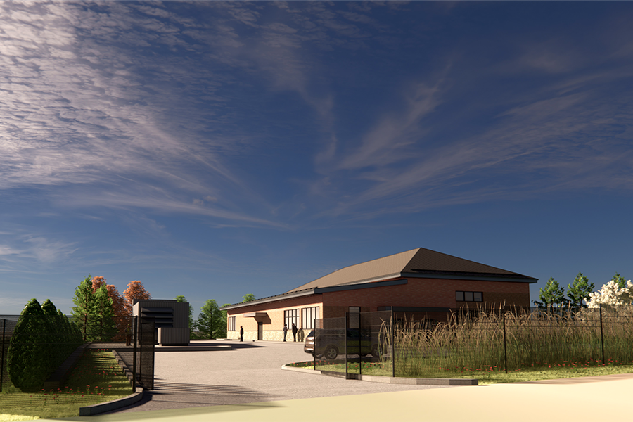
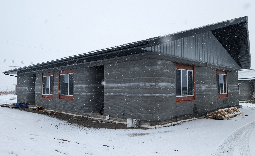
To eliminate the need to haul and off-load approximately 40,000 to 55,000 cubic metres of leachate per year from the closed landfill facility, the Region engaged Associated Engineering to complete the preliminary and detailed design for a new submersible wet well leachate pump station and 100 millimetre force main (twinned for redundancy), connecting the station to the adjacent Neyagawa sanitary sewer.


Project Highlights


Choosing the force main routing and pump station design involved evaluating numerous factors. These included the presence and location of contaminated fill, unforeseen waste disposal areas, boulder, debris, and refuse within the working limits. In addition, consideration was given to the variable nature of the fill material, which would be controlled by selecting a less steep trench side slope or by providing lateral support to the trench walls. Special consideration was also given to the overriding environmentally sensitive areas and minimizing adverse effects on surrounding wildlife habitats.
We also provided contract administration and inspection services throughout construction.
More Infrastructure Projects
See all projects


Transportation
Cold Lake CRISP


Bridges
SkyTrain Grandview Cut Structural Upgrade

Infrastructure
Municipal Incentives to Attract Downtown Investment

Airports
Inuvik Airport Runway Extension and Airside Civil Infrastructure Improvements

Infrastructure
Melville Water Treatment Plant


Energy
Site C Clean Energy

Infrastructure
Highway 69 Twinning


Water
Jericho Reservoir


Environmental
Drinking Water System Improvements in Quaaout Community

Environmental
Tlichǫ Cultural Commons Digital Database

Infrastructure
Roads and Drainage Construction, Lake Babine Nation

Infrastructure
Kluskus Village Domestic Water System Improvements

Infrastructure
Greens on Gardiner

Streetscaping
Nigel Valley Public Spaces

Infrastructure
Kikendaasogaming Elementary School Deficiency Repairs
LEADERSHIP INSIGHTS
See all insights