
Location
Dawson City, Yukon
Expertise
Transportation Planning
Share
The Goldfield Roads are a network of seasonally maintained gravel resource roads that access the Goldfields.
The roads are used extensively during the spring, summer, and fall months providing access to approximately 200 active mining land use permits for placer and quartz mining properties. Placer mining activity within the Dawson Goldfields accounts for the majority of placer gold production in the Yukon (approximately $60 million annually) and is a critical industry for the local economy. Therefore providing safe, reliable, and efficient road access to support the existing mining operations and promote further development of the area is essential.

Client
The Yukon Government

Project Highlights
200
active mining land
5
individual roads
250KM
length


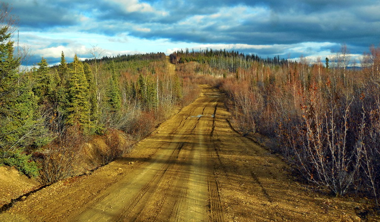


The Yukon Government retained Associated Engineering to complete a Functional Plan for the Goldfield Roads network which included five individual roads with a total length of approximately 250 kilometres. The Functional Plan considered the existing seasonal use, as well as the requirements to develop the Roads to an industrial haul route standard suitable for year-round operations and maintenance supporting mine development in the area.
We completed a site visit with the Yukon Government to assess the existing condition of the roads, culverts, and bridges. Common issues and deficiencies were noted with respect to geometrics, steep grades, road width, roadside drainage, glaciation, culvert condition, vegetation, and lack of gravel structure and surfacing material. We provided improvement options and order of magnitude cost estimates considering the requirements to maintain the road on a seasonal basis, as well as the improvements required for the roads to be operated and maintained year-round to support mining development in the area.
More Transportation Planning Projects
See all projects


Roads
Transportation Planning Studies


Highways
Saskatoon ITS Needs Assessment

Transportation
Shell Canterra Road

Streetscaping
Vanalman Avenue Upgrades

Infrastructure
Lakeshore Drive Redevelopment

Roads
North West Welland Secondary Plan

Streetscaping
Nigel Valley Public Spaces

Transportation
Fourth Street Pedestrian Overpass

Transportation
Sutherland Ave Pedestrian Bridge

Traffic Engineering
Imagine Idylwyld

Transportation
Northwest Territories ITS Program

Transportation
Cold Lake CRISP

Transportation Planning
Nahanni Range Road Functional Plan

Infrastructure
Highway 69 Twinning

Infrastructure
Fringe Area Development Assessment
LEADERSHIP INSIGHTS
See all insights


