Location
Cowichan Valley, British Columbia
Expertise
Transportation
Bridges
Bridge Asset Management & Inspection
Structures
Infrastructure
Asset Management
Share
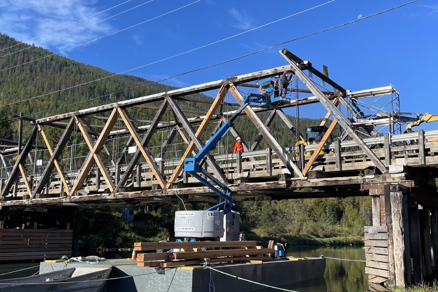
The BC Ministry of Transportation and Infrastructure retained Associated Engineering to conduct condition inspections and load rating of five bridges along the Cowichan Valley Trail between Duncan and Lake Cowichan on Vancouver Island.
The bridges were former CN Railway bridges that were originally constructed in 1921 to transport timber and have been repurposed as part of the Trans Canada Trail.
The bridge inspected were the 64.4 Mile Bridge, 66 Mile Bridge, 70.2 Mile Trestle Bridge, Fairservice Creek Trestle Bridge, and the Holt Creek Trestle Bridge. They are some of the few remaining examples of significant engineering works associated with early twentieth century transportation history on Vancouver Island and the large and complex timber trestles provide an evocative window into the logging history of British Columbia and are recognized heritage resources of the Cowichan Valley Regional District.


Project Highlights


The bridges inspected comprised timber and steel trestles which presented inspection access challenges. To provide an economical and efficient inspection program we proposed a staged approach that initially focused on visual inspection of all accessible components. Following the completion of the visual inspections, we prepared inspection reports for all the bridges using the Ministry’s Bridge Information Management System and provided annotated photographs documenting the condition of the bridges along with recommended remedial works that the Ministry should complete to extend the bridges service life. We also completed load ratings on all the bridges and provided a summary report detailing our assumptions and conclusions.
More Transportation Projects
See all projects


Transportation
Coast Meridian Overpass

Transportation
LNG Canada Heavy Haul Bridges

Transportation
Bellevue Creek Bridge

Pedestrian Bridges
Hangingstone River Pedestrian Bridge

Transportation
Sutherland Ave Pedestrian Bridge

Transportation
Miette Hot Springs Culvert and Bridge Replacement


Infrastructure
Baxter Bridge Rehabilitation

Transportation
South Fraser Perimeter Road – Bridge Structural Engineering Services

Transportation
Ice Engineering and Ice Safety at Milne Inlet

Active Transportation
Highway 1 at Mountain Highway Interchange

Transit
SkyTrain Fraser River Crossing North Approach Spans

Transportation
Medicine Hat Transit ITS Decision Support

Transit
SkyTrain Crossing of South Point Drive

Transportation
Little Smoky Bridge Inspection, Load Rating and Assessment

Airports
Nanaimo Airport Airfield Electrical Upgrading
LEADERSHIP INSIGHTS
See all insights